


Les crêtes depuis la Motte d'Aigues

JMCMoreau
User
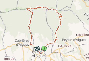

Length
18.4 km

Max alt
1062 m

Uphill gradient
800 m
Km-Effort
29 km

Min alt
358 m

Downhill gradient
802 m
Boucle
Yes
Creation date :
2019-11-26 06:37:55.564
Updated on :
2020-02-10 03:58:15.1
7h00
Difficulty : Difficult

FREE GPS app for hiking
 SityTrail
IGN / Geographical institutes
SityTrail Plus
The world is yours!
About
Trail On foot of 18.4 km to be discovered at Provence-Alpes-Côte d'Azur, Vaucluse, La Motte-d'Aigues. This trail is proposed by JMCMoreau.
Description
Randonnée pédestre qui répond aux attentes des sportifs.
Magnifiques points de vue.
Quelques passages délicats.
Des crêtes on domine la vallée d'Aigues et le mont Ventoux
Positioning
Country:
France
Region :
Provence-Alpes-Côte d'Azur
Department/Province :
Vaucluse
Municipality :
La Motte-d'Aigues
Location:
Unknown
Start:(Dec)
Start:(UTM)
703044 ; 4849753 (31T) N.
Comments